
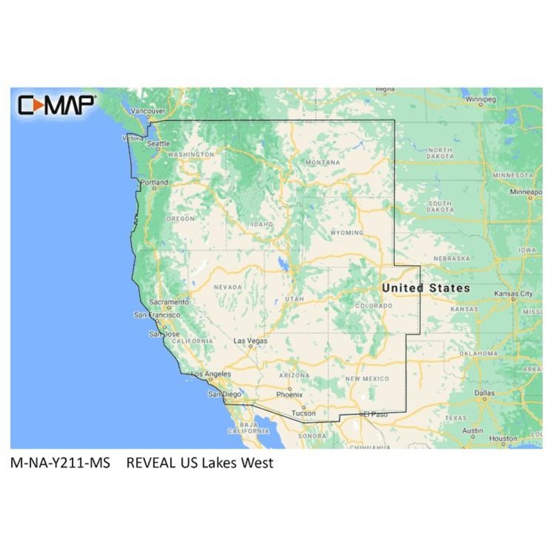
Description
C-MAP REVEAL charts display the very best of C-MAP. With Shaded Relief, including game-changing Ultra-High-Res Seafloor Imagery unique to REVEAL, Aerial Photography, Satellite Overlay and Dynamic Raster Chart presentation added to the core C-MAP features found in DISCOVER
Vector charts, including Depth, Contour, Spot Soundings, NavAids, Light Sectors, Wrecks/Obstructions and more
Display the highest level of information, setting clear safety depths and identifying underwater pinnacles, ledges and canyons, magnets for coastal game fish
High resolution detail of nearshore & offshore features such as pinnacles, canyons and ledges helping anglers, includes Genesis data
Automatically plots the shortest, safest route based on detailed chart and vessel information. Takes two points and generates a suggested route
Displays the time, water level and direction of tides with Tide Level graphs and indicates predicted current time, direction and strength. Flow graphs and coloured arrows
Raster charts bring a traditional paper chart look and feel
Shaded Relief presents the data with a 3D appearance, which is easier to interpret versus traditional contour lines
Satellite imagery provides realworld reference, enhances situational awareness for coastal navigation
Shaded Relief
Full-Featured Vector Charts
High-Res Bathymetry
Custom Depth Shading
Dynamic Raster Charts
Easy Routing
Aerial Photos
Satellite Overlay
Tides & Currents
Detailed Marina Port Plans
Harbor & Approach Details
Online Updates including 12 months free online updates
Compatible with Lowrance, Simrad & B&G chartplotters

Reviews
There are no reviews yet.